From the 4th to the 7th of June, I spent four days hiking along the peaks of the Yatsugatake range, a beautiful if not every well known (at least among foreigners, that is) series of ancient volcanic mountaintops nestled between the Southern Alps, Mount Fuji and the Okutama mountains. Topping out between 2500 and 2900 metres, they’re definitely high enough to get somewhat puffed out along the route. I kept a diary at the end of each day, and share it below:
Day 1
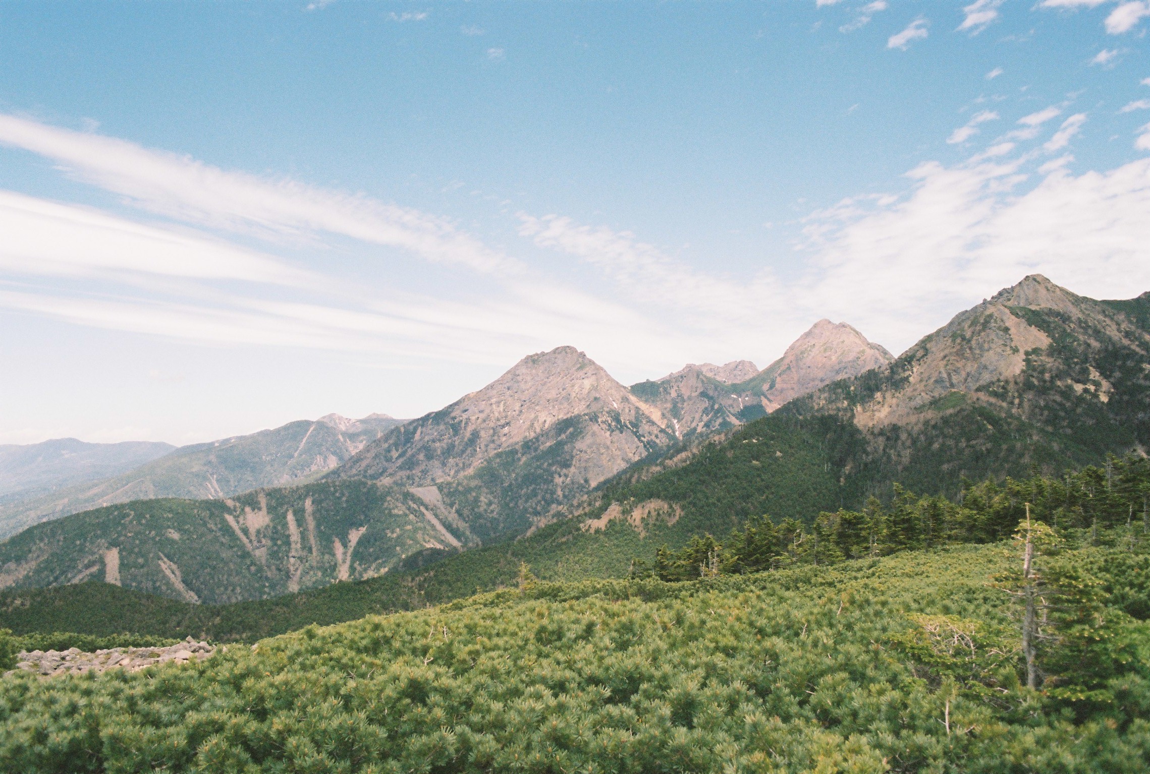
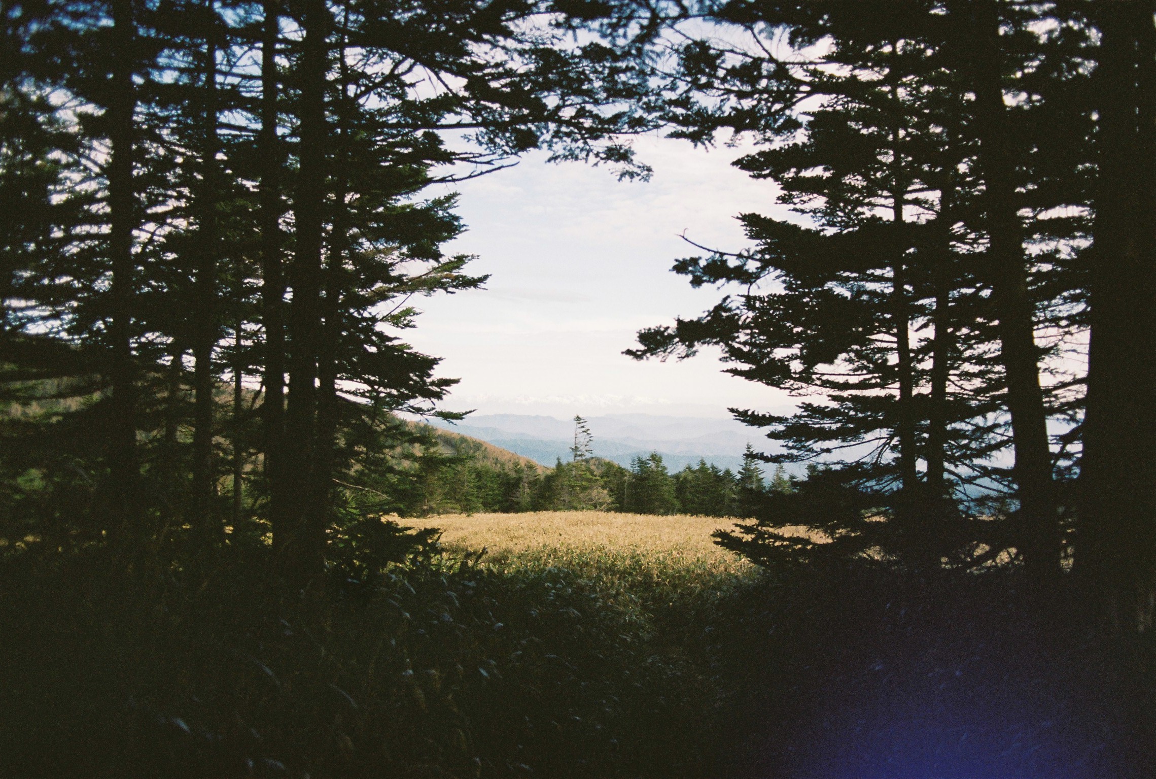
Just from looking at my handwriting it should be clear that i am exhausted! The day started easy enough with a stroll through the forest towards mount Amigasa. Even though it was only early June, the cicadas were already gleefully belting out their maddening shriek, and I was excited to move higher, beyond them. The trail up Amigasa started strong and only really got worse. I was absolutely dead once I had summited the first of the many peaks that lay ahead (here I don’t bother counting them as the definition of a peak or a ridge on this range isn’t exactly clear).
The weather, however, was perfect, and I enjoyed the shade from the passing clouds while still getting fantastic views. It had been raining the days before and the air was crystal clear as a result. The snow-capped Southern Alps in particular were stunning, and I already felt a huge sense of gratitude for the ability to see them from this height.
On reaching Seinen hut, I had a pleasant conversation and lunch with some other hikers, one of whom might well be coming my way in the morning tomorrow (he would overnight at Seinen hut and set off at 3 AM(!), meeting me at my intended camp spot at 6 AM or so). His idea was to summit Aka-dake, the highest and meanest peak in the range and continue on to Oren hut about 15 kilometres away all in one day. I filled up my water bottles at a really bountiful (and delicious) natural spring near the hut, then bidding my farewells to my dining companions as I continued my way up towards Mount Gongen, sitting at a little over 2700 metres in height.
I was aware that with Japanese hiking culture favouring a start and finish early model when it comes to daily routines, I might end up as the last guy on the mountain after leaving Seinen hut. So it was with some relief that I met a talkative fellow on the way up the steepest section of the climb and chatted with him about conditions and routes for a few minutes. He was doing the whole of mount Gongen as an out and back day hike!
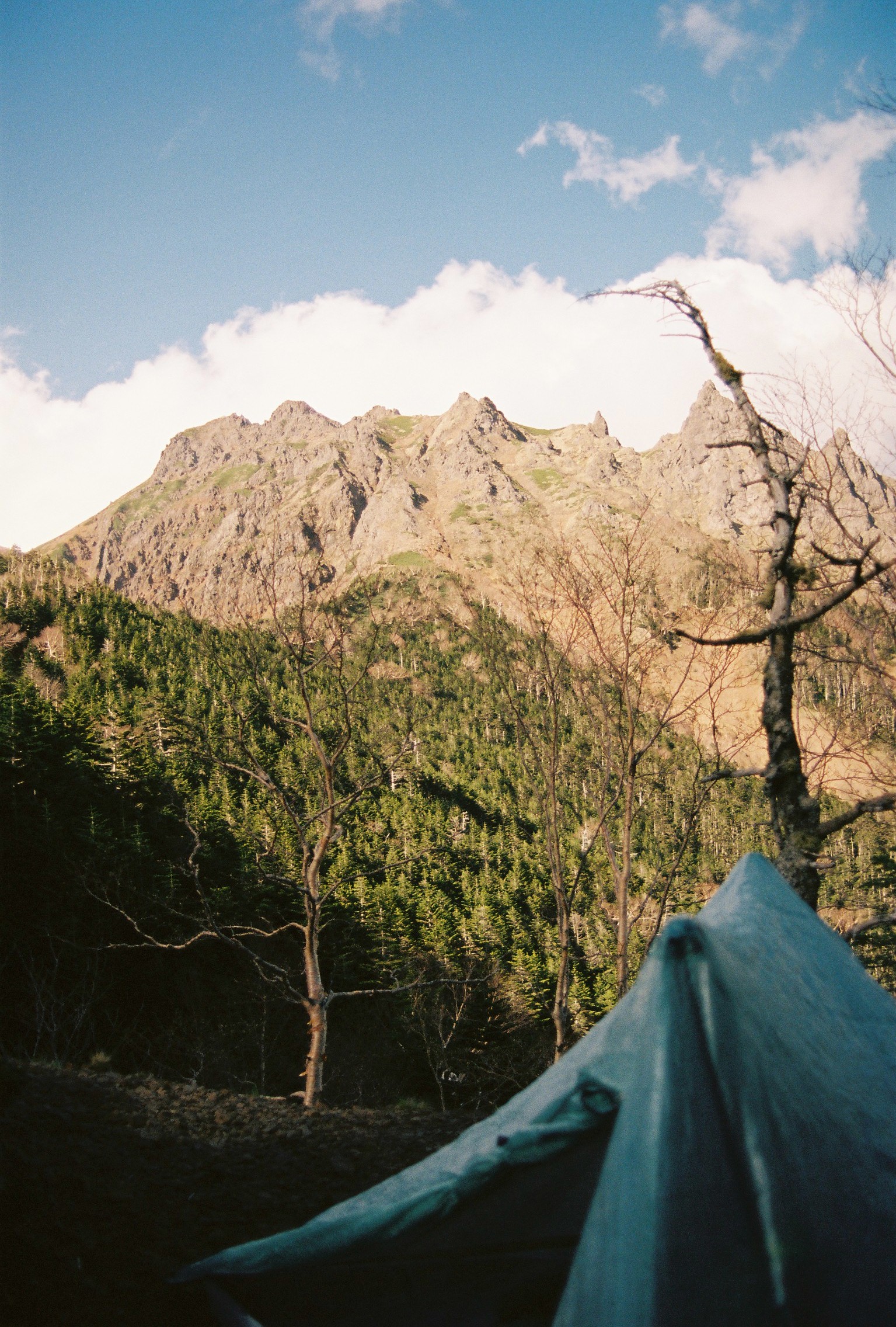
After that I was entirely alone along the perilous kiretto (knife-edge ridge) between the peak of Gongen and my final destination of the day, the aptly named (and entirely abandoned?) Kiretto hut campsite. Taking my time, I got there sure enough, but I found descending the 20 metre ladder that’s a highlight of the route heartstopping; the wind had been picking up through the afternoon and the ladder itself is not only exposed, but also elevated several metres off the ground. Too scared to take a picture myself, I link one here. All the while looking ahead to the impossible-seeming ascent of Aka-dake, which had its own dark and stormy little cloud capping the mountain for much of the day. I can’t say I loved that section. I arrived as the only person at the campsite and look forward to a peaceful night’s sleep. Flat spot! Aka-dake view!
Day 2
Ha. That night’s sleep was anything but peaceful. The wind came and blasted my tent every hour or so, waking me up confused and concerned about the integrity of my tent. Mountjack deer barking/shrieking in the woods also tend to keep you up. On top of that the occasional sound of rocks clattering down the steep and fragile mountainside did little to ease my anxiety. Little did I know this was a portent of things to come. After packing up in the gale, where miraculously the tent (which has the consistency of plastic bags) did not fly off into the abyss below, I aimed for the camp exit.
Setting off, and noticing shimobashira or needle ice growing out of the ground, I realised that I may not have prepared properly for the cold temperatures. I had assumed, given that it was June, that it would be mild. As I made my way up the first gentle hill of the climb, I looked behind me to see none other than the guy I would come to know as Ao-san, making his way down the hill towards my campsite. I decided a little delay would be worth it in order to have a climbing companion given the sunny but cold and windy conditions. I did not regret this decision at all, and we walked together for almost the entire day.
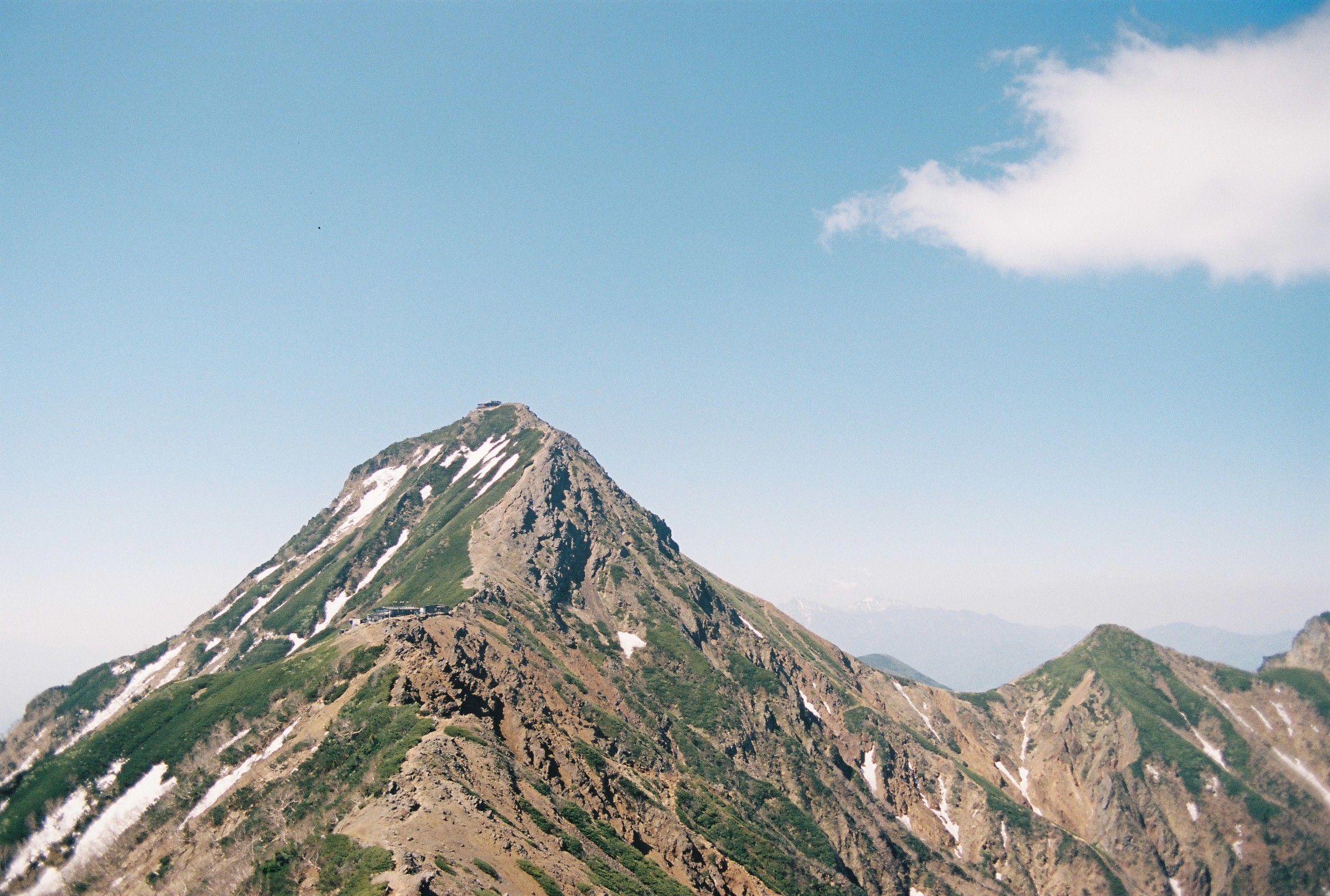
After returning to the campsite to let him catch up, we exchanged greetings, talked about conditions and then set off on what would become easily the most momentous climb of the trip and possibly my life so far. Aka-dake. No matter what direction you look at it from it look steep and mean. A small Matterhorn, or craggy volcanic tooth. Steep-sided and very separate from the other mountains in the range.
Slowly scrambling up the side of the mountain, the face was steep, formed of loose rocks, and the strengthening gale was beginning to threaten to blow us off. Not hyperbole; we were losing footing and getting pushed around. To add insult to injury, we were climbing on the shaded side of the mountain, and my hands and feet rapidly began to lose feeling in the cold. My helmet, ostensibly to protect me from falling rocks, would continuously catch on my backpack and prevent me from looking further up the route. Maybe that was for the best. The comical steepness and sense of extreme exposure had me so scared I thought I would be sick at times. A genuine chance of death that morning.
Clearly, we survived. Towards the peak we passed a small group of what looked like three guides and three elderly women making their way down in full mountaineering gear and tied together with ropes. It was obvious they had managed their risk much better than we had, but I was worried for them nevertheless. Anyone who’s spent some time in the mountains can tell you; somehow descending is worse. Reaching the 2899.4 (so close to 2900!) metre peak really carried a heavy feeling of having just about made it, rather than celebrations.
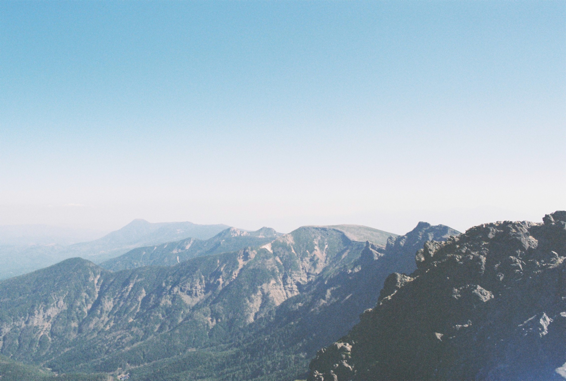
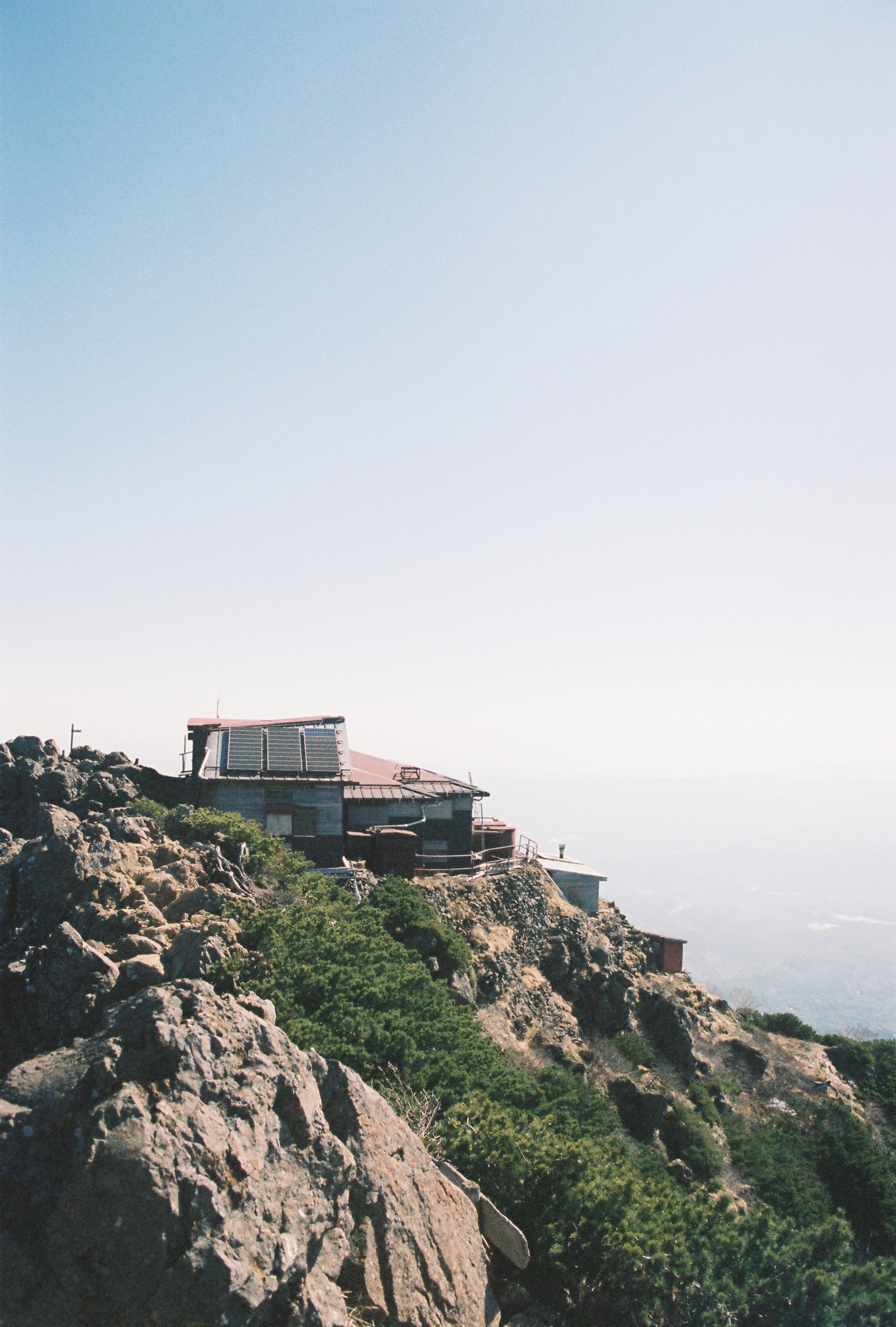
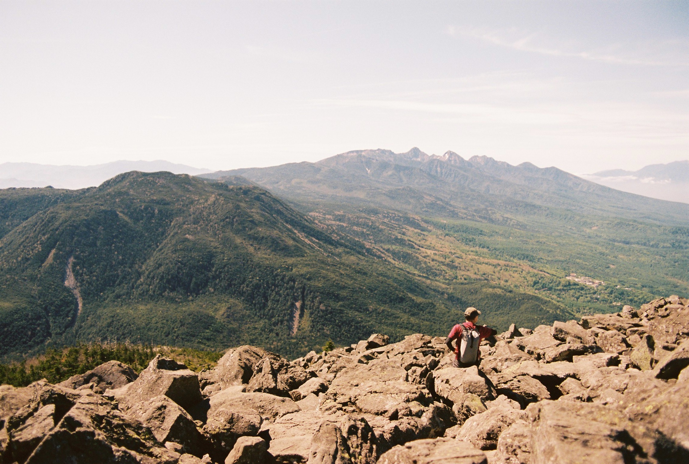
After Aka-dake, the subsequent peaks that day (Yoko-dake, Io-dake, Mount Neishi and Higashi Tengu-dake) felt like child’s play. And indeed with the wind calming down and the temperatures rising I began to have fun again. All those chained sections, ladders, and dicey maneuvres were now enjoyable rather than life-threatening. First the rugged spires of Yoko-dake, ladders, chains and all, and passing the last remaining active volcanic area on the range. Then a quick stop for lunch at one of the many mountain huts along this part of the range. They even had washlet bidet toilets! So deluxe…
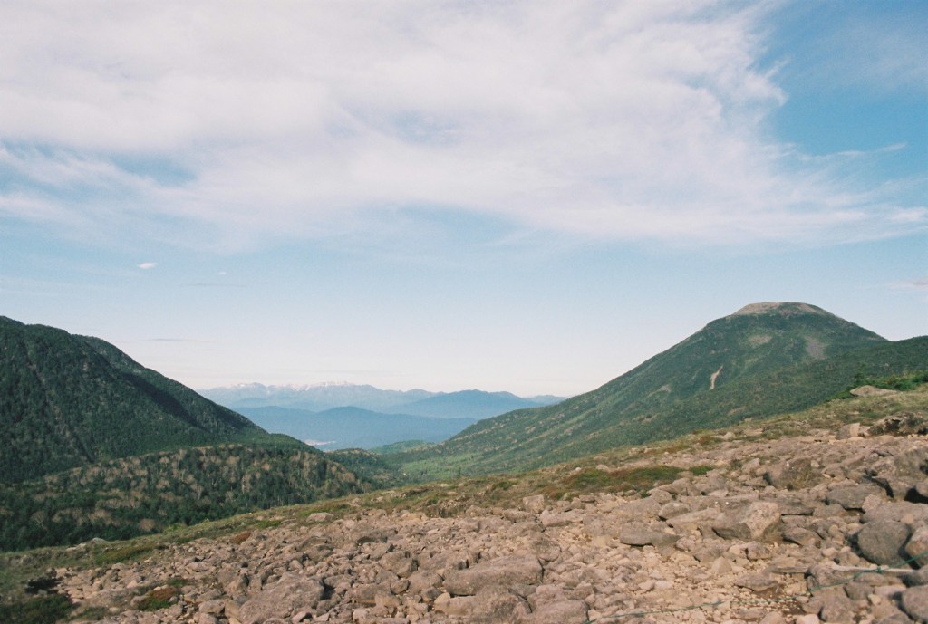
On scaling the flat-windswept summit of Io-dake and guided along our path by enormous three metre high cairns, I learned that in Japan they just yoinked the word straight from English. Or Gaelic, should I say. Ke-run. Looking back at the peak of Aka-dake one more time, we then finally made our way down towards Natsuzawa pass, catting about other mountain ranges and hut culture. A long and not entirely unpleasant descent took us to the saddle in the middle of the range where the Northern and Southern Yatsugatakes are separated. The nature of the range changes dramatically here. The south is sharp, and alpine in nature. North of the pass the mountains keep most of their height, but become softer, rounder and strewn with round boulders. Suddenly you’re not walking along exposed ridge lines, but rather through mossy forests.
It was here that I bade farewell to Ao-san. It was poignant, losing the company of someone who suffered through so much with you over such a short period of time, and one who then became a reliable and fun presence along the way. As he took the path turning west, down from Natsuzawa pass and onward to Oren hut where a hot bath and warm bed awaited him, I was left alone again. I took a moment to drink in the scenery and reflect on how far I had come before setting off towards the final two peaks of the day.
Climbing in wonderful solitude up the gentle slope towards Neishi-dake, I noticed the smell of pine sap in the air as the sun warmed the trees, which gladly released their fragrance in response. Further up the slope the path was occasionally blocked by mounds of lingering snow. Nothing too hard to work with but still surprising. Neishi-dake was one of the smaller bumps in the ridge line (though still well over 2600 metres in height). It didn’t take me too long to summit, where I had a brief chat with an elderly couple who were excited to find a foreigner hiking the Yatsugatake traverse. Apparently we all go to the Northern Alps. I believe it.
Finally I was on familiar ground. The junction where the Shirasuna-shindo trail rises up from Honzawa hot springs marked the point where I had crossed the range from East to West last autumn. Summiting Higashi Tengu-dake was far easier than I remember it being before. Maybe it’s just experience. Making good time, I began the final descent towards Kuroyuri hut. Here the trail offers you two choices, both taking you to the same destination. I chose to take the western route, one I hadn’t done before. Stupid boy, that was a bad choice. Interminable bone-shaking rock-hopping awaits the foolish! There was no trail, just rocks with arrows etched into them. It sucked, whatever.
I was therefore in no mood to suffer a friendly but irritating camper giving me the ‘where are you from?’ treatment in broken English despite my replies being all in Japanese (and not to blow my own horn but I’m told I sound more or less native at this point). Leave me alone dude, I’m not here for you to practice your English, I’m angry about those rocks and just want to set up my tent.
After getting over that snag I had a lovely evening at the pleasant Kuroyuri campsite, cooking myself a small meal and wandering out along the duckboards towards a nearby viewpoint as the sun was setting. I took pride in having now made it to the beautiful, heavily forested northern Yatsugatakes and looked forward to my journey through the woods towards Futago-ike cabin, my third and final stop.


Day 3
On reflection, despite sleeping pretty well at Kuroyuri campsite, today was a day of simply slogging through it and not getting too caught up with whether or not I would make it to Futago-ike cabin in time (pro-tip: I absolutely did). The first mountain of the day was Nakayama, and the trail up to its peak was pleasant enough, and not too steep. Though already it was impossible to escape today’s theme: giant boulders that simply must be clambered over if you want to get where you’re going. Thankfully I didn’t end up rolling an ankle or anything like that.
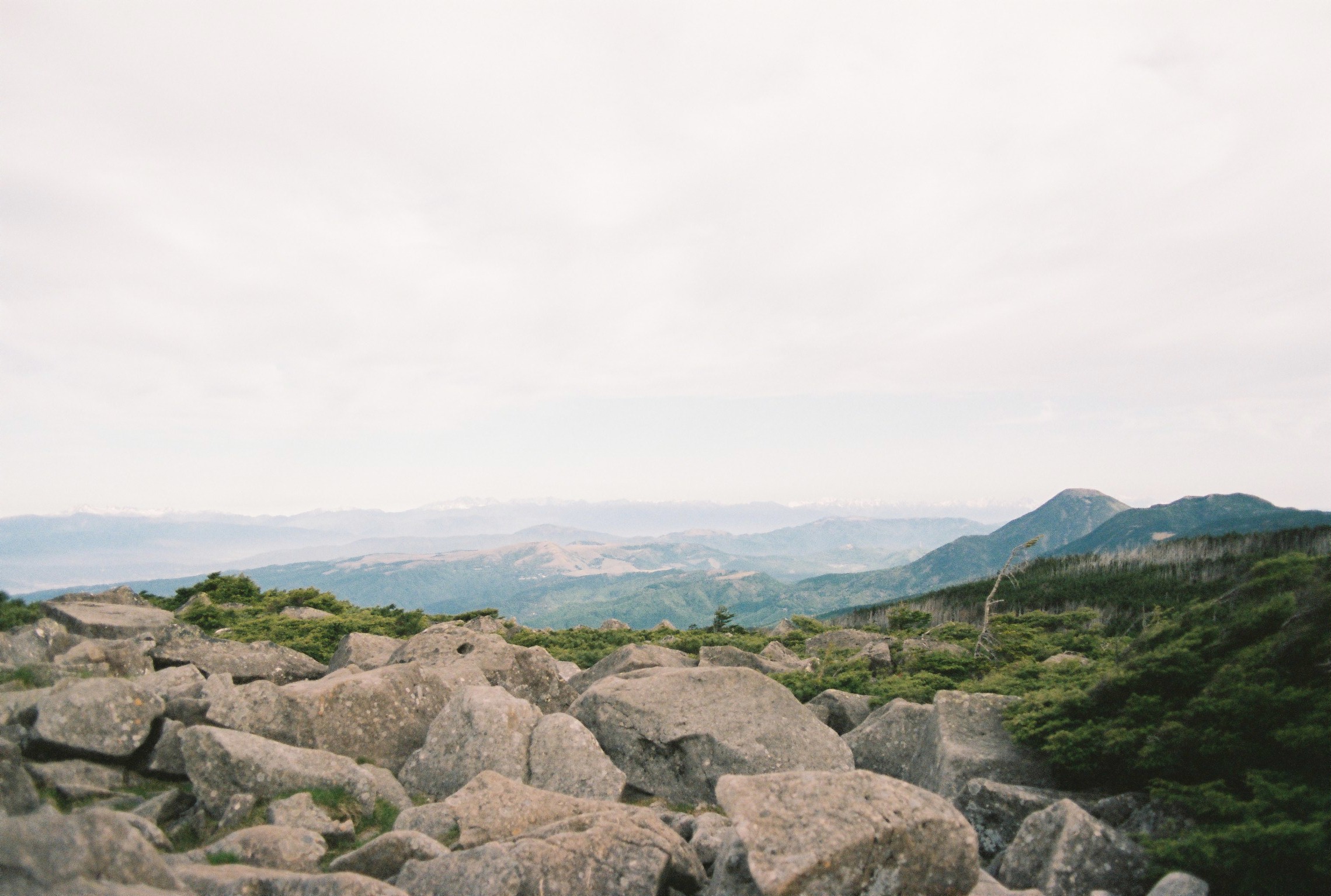
After taking in the views of the Northern Alps (finally!), which were still completely bedecked in snow – last winter was a famously snowy ski season – I began the somewhat desperate descent down towards Takami-ishi hut. Desperate? Well, I wanted to use the toilet on leaving the campsite but some guy had been dominating the bowl for at least 15 minutes and I decided to roll the dice and try for the next hut along the trail. I guess I rolled a 2 or something. After an increasingly frantic descent, I plowed into the toilet block and got to work. Crisis averted. By the by, this hut could have been where I overnighted, but the campsite looked quite small and I knew Kuroyuri hut pretty well. What I missed out on through this decision was stargazing from the massive natural standing stones just a couple minutes away from where you pitch your tent. Next time, maybe.
Moving on to the first real summit of the day (as Nakayama really felt more like a gentle slope up and a gentle slope down), I made short work of what a small and in the end, forgettable mountain – Maruyama, and began my descent towards Mugikusa pass. Leaving the forested trail and seeing the vista open up to a sea of sasa bamboo grass and the red roof of Mugikusa hut perched among it brought great relief from the drudgery of endless boulder hopping in the forest. Weirdly it was nice to see a road too, a little flash of civilisation after being stuck out in the woods for a couple of days.
I bought a little Pocari Sweat at the hut and crossed the road towards Chausu-yama. The start of the climb was so easy! So wonderful! Gently sloping duckboards! Of course, this doesn’t last all that long, and I got to climb another 200 metres in elevation over my beloved boulders. I think I may have pushed it too hard getting through that section of climbing, as I was basically a zombie for the rest of the day. Every subsequent climb felt like a herculean effort. And; although none were particularly long, the climbs were many today. Shortly after Chausu-yama came Shimagare-yama, where the first person I met was a young girl walking two enormous English Sheepdogs. Was I hallucinating? It doesn’t matter. They were very well behaved.
The descent down to Ama-ike pass was comparatively easy, and soon I was on the duckboards in another sea of bamboo grass, with the bright blue peaked roof of Shimagare hut poking up between the scattered trees. I wanted to sit down and get a little food, as I was beginning to be repulsed by my camp rations, but the owner popped out and said they don’t serve food to non-guests. Ok. I move to sit on the terrace to catch my breath and take a bite to eat. Nope, can’t do that. You need to buy something to sit there. Hello? I’m the only person around for miles. Fine I’ll have a tea. No I don’t care how you serve it it’s just an excuse to sit here. In the end the owner was quite nice and was curious about the journey I had taken so far.
My final major climb of the day was ahead of me. Kitayoko-dake. I was grateful that there’s actually an aerial tram top station nearby, as it meant that the paths were very well prepared and I got a reprieve from those fucking boulders. It would have been (almost) a walk in the park were it not for the fact that I had basically crashed and was completely out of energy. Really long, painful slog upwards, that. Nevertheless I summited with a few tourists who had ridden up most of the way on the gondola. Normally I’d be judgemental or at least haughty towards them, but in the end I didn’t care, I just wanted to get up there. Is this character development? Probably not.
I knew that from the topographical maps, the descent towards Kikou pond was going to be long and steep, and to that extent I was dreading it. It ended up being a breeze, as unlike a lot of trails in Japan, there were actual, real hairpins in the trail to make it easier! I have had plenty of experience with trails simply straightshotting it up the side of a mountain. It’s not much fun.
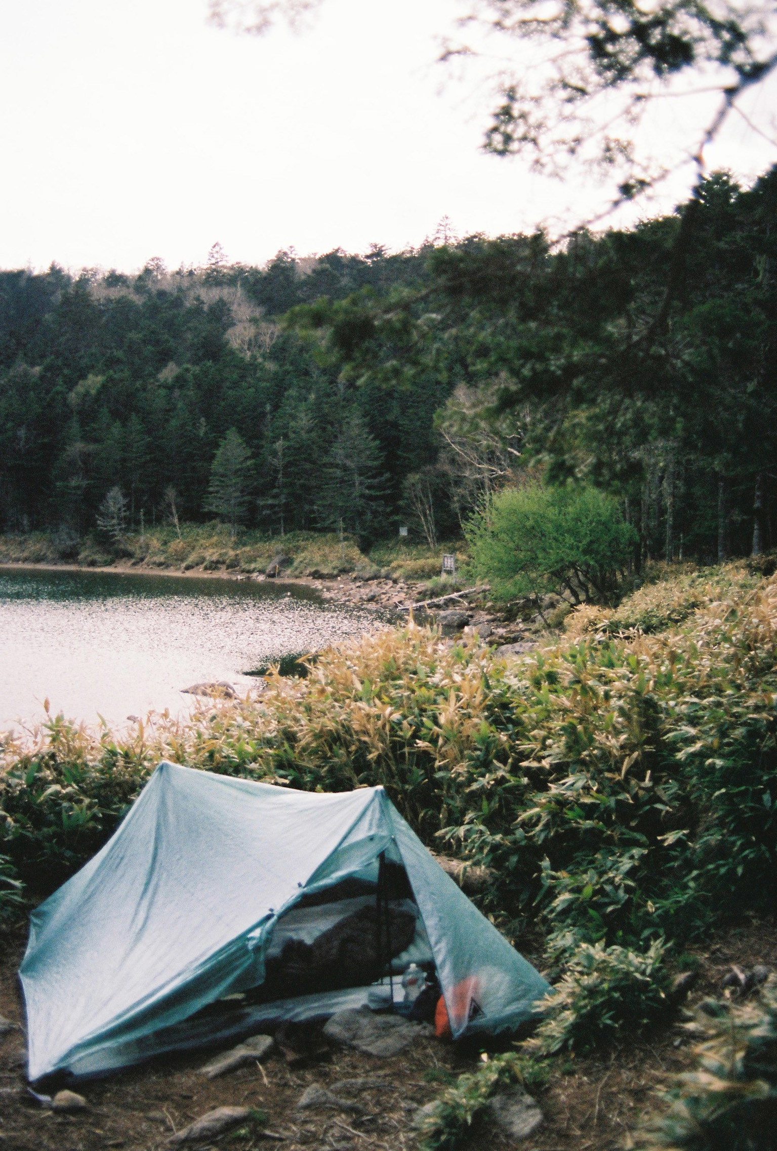
The final, tiny climb up and over a small saddle in the mountain range felt truly impossible. I was ruined. This whole day had been an endurance challenge, and I was at my limit. Eventually I arrived at Futago-ike cabin, and secured myself a beautiful camping spot by the lake. I had read reports the owners could be difficult and strict with rules, but they were very warm and welcoming to me, and I was massively tankful for having decided to buy dinner at the cabin, as the gigantic duck on rice dish I had was precisely what I needed.
Dinner for the campers was served outside, and myself and two others got talking over our bowls. I found out that I hadn’t hallucinated the sheepdogs as the lady across the table had been about an hour behind me (coincidentally starting her hike at Oren hut) and excitedly told me about these giant dogs too. it turned out that we were going the same way tomorrow as well. Meanwhile the owner’s lovely Shikoku-inu? Shiba-inu? – I’m not sure the breed of dog – was stretching and snoozing nearby after getting brushed. Her name was Azuki, or red bean in English.The evening was very pleasant, and as the sun went down, the insects seemed to go to sleep and I had a peaceful night’s slumber.
Day 4
I think I should mention here that after day two, I was somewhat saddened or even a little jealous every time I heard of someone finishing their hike. I could only think of warm baths, not stinking, and a belly full of dhal, specifically. So it became such that the final day was somehow momentous for me, it felt like I had finally broken the back of the trip and only had one more major mountain left to climb, Mount Tateshina.
It had taken me some time to fall asleep, but in the end I slept well, and the ridiculously delicious dinner bolstered my energy for the day. That being said, I started the day feeling genuinely fearful for how tough I would find the final stretch, but fairly quickly learned that it would basically be fine. I left the campsite and waded through shoulder-high kuma-zasa grass for a couple hundred metres of climbing. Normally I’d be fearful of bears, but the cabin owners had told me there’s only one transient bear in the area, and it’s mostly boars in heat that are most likely to gore you. There were occasional rustlings among the stems, but I told myself it was just deer and moved on.
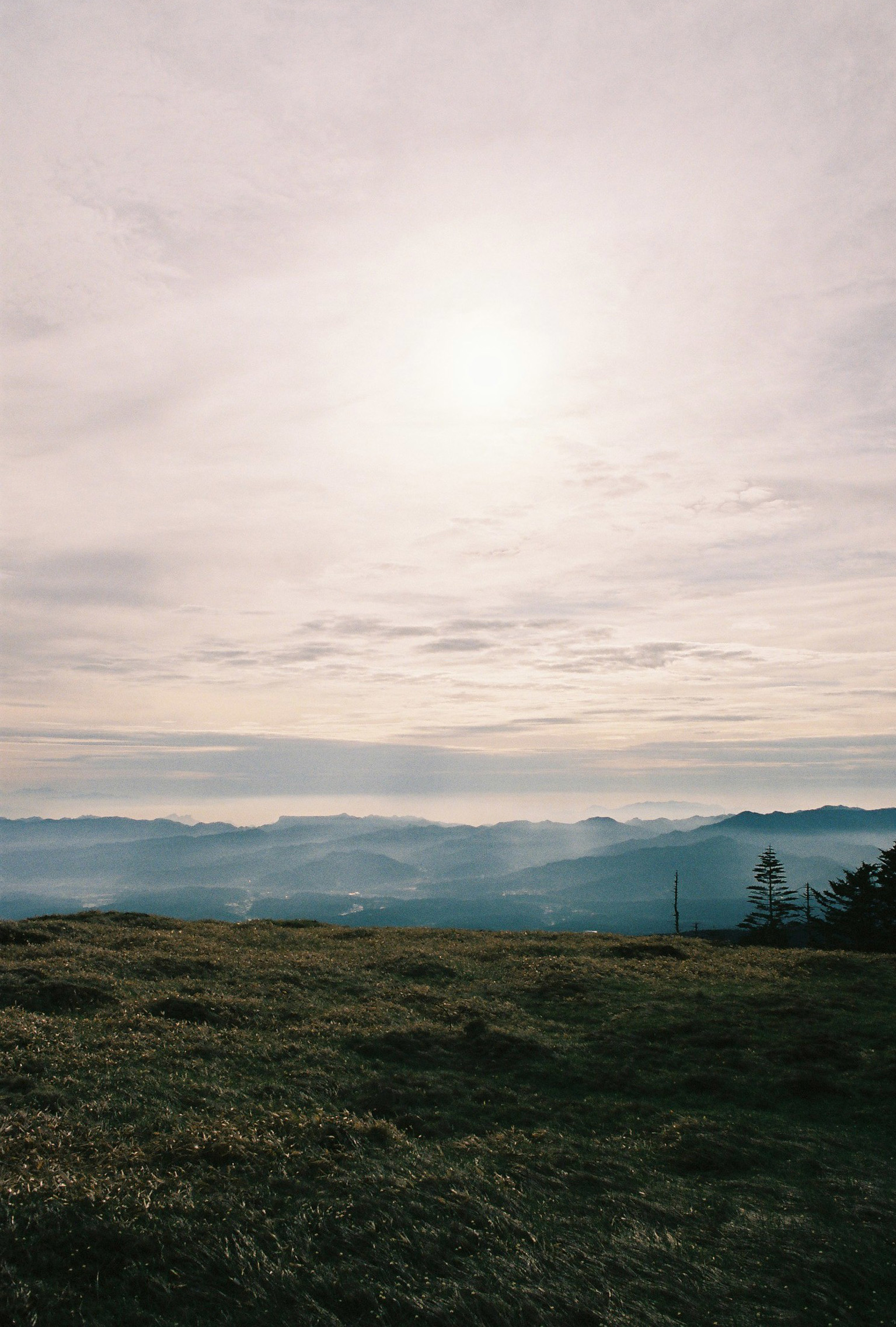
The climb was surprisingly tough, but I made it to the summit of the smaller Futago-yama mountain. At that altitude the grass became short and stubby, and I was rewarded with maybe the best view on the trip. The early dawn light illuminating the faraway Northern Alps, their snow-capped peaks a delicate peach shade, the menacing volcanic cone of the very much active Mount Asama across the valley, and further across to the endless ridge lines of the Okutama mountains in the direction of Tokyo. The gigantic gojo-iwa boulder at the summit of mount Kinpu clear as day. I was struck, was this my reward? Is this where I melt down? (No).
I descended to the final saddle pass to begin what would be the hardest climb of the day. A consistently steeply pitched trail ascending three hundred metres through rocky woodland to reach the ridge that effectively formed the shoulder of Mount Tateshina. About halfway up I bumped into a lithe young cabin staff member, wiping sweat from her brow. We got talking for a while, and I only then noticed she was carry about 30-40 kilograms of supplies up to the Tateshina mountain refuge. Once a week she’d make the burdensome pilgrimage. I was gobsmacked.
Once I had made it to the top of the climb, I was rewarded with a comfortable flat walk towards the Tateshina refuge, where I was able to think about just how far I had come and what I had managed to achieve. I’d never hiked more than two days in a row before that. Here I was, on my fourth day and still plugging along, and about to complete the whole damn thing! To think I was considering cutting off early the day before when the going was getting just too hard to bear.
The final climb was almost religious. The boulders were bigger than ever, the path steeper. There was no ground, with yawning gaps between the enormous rocks. I was forced to slow down, and take my time. Every step laden with meaning and intent. I was almost overwhelmed with emotion and felt my eyes watering several times as I made my way up. This is it. You’re nearly there. Well done. I felt like I was meeting my fate somehow. Reaching the 2530 metre summit of Mount Tateshina felt like the end of a long dream. It was warm, sunny, and there was no wind at all. I could see all across central Japan, and my entire route to get here. I sat down for a while.
Sadly, all good things come to an end, and I had to make my way down about 1500 metres vertically to get to the bus that would take me home. In this case the descent really was just a straight line down the mountain, and I found myself repeating “I hate gare (scree, loose rocks)!” in my head over and over as my knees slowly got beaten down to a pulp. Of course, eventually I made it, and I was surprised to hear the hiker I shared dinner with last night calling out for me, having just caught up right at the bottom of the trail. We took some commemorative selfies on her 360 camera and shared some pleasantries before parting ways, as I had another hour of walking to go before getting to my end point.
Finally at the bus stop, I knew there was a hot spring nearby, and I gladly took the chance to wash off four days’ worth of filth and stink before the long journey home. I’m just grateful no-one commented about how gnarly my socks were after all those days. One surprising thing I discovered was that I had lost about 5 kilos over the course of the trip. I’m sure most of that is water weight but if you need to shape up quickly for summer I might have a suggestion for you…
